Mapas Atuais - Página 01 de 01
![]()


Mapas Atuais - Página 01 de 01 |
|
 |
1115002001 Micro Região JF.JPG (53.97 Kb - 1000 x 797) |
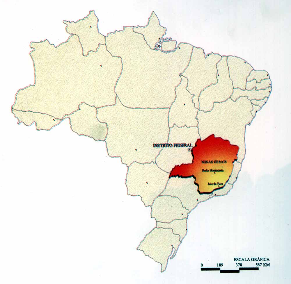 |
1115002002
Mapa do Brasil 2.JPG (77.50 Kb - 1000 x 977) |
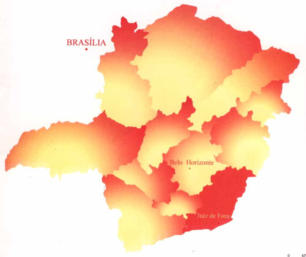 |
1115002003
Minas Gerais.JPG (32.32 Kb - 1000 x 842) |
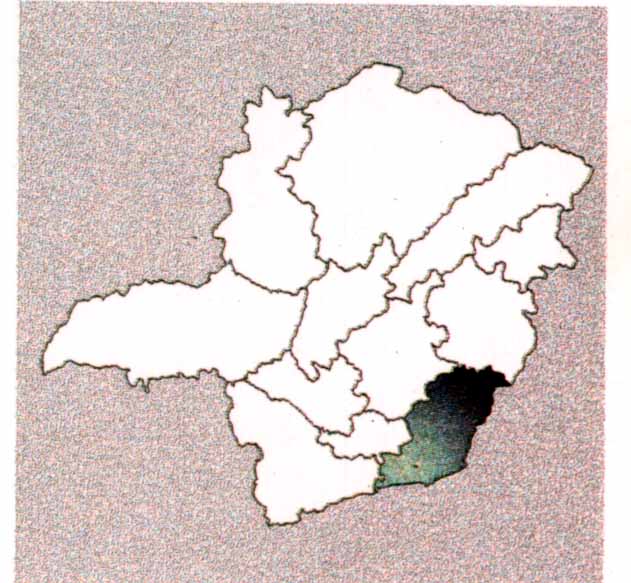 |
1115002004 ZM em
MG.JPG (53.48 Kb - 631 x 583) |
 |
1115002005
Zona da Mata.JPG (59.36 Kb - 1000 x 960) |
 |
1115002006 MG
Leste.JPG (118.85 Kb - 826 x 1082) |
 |
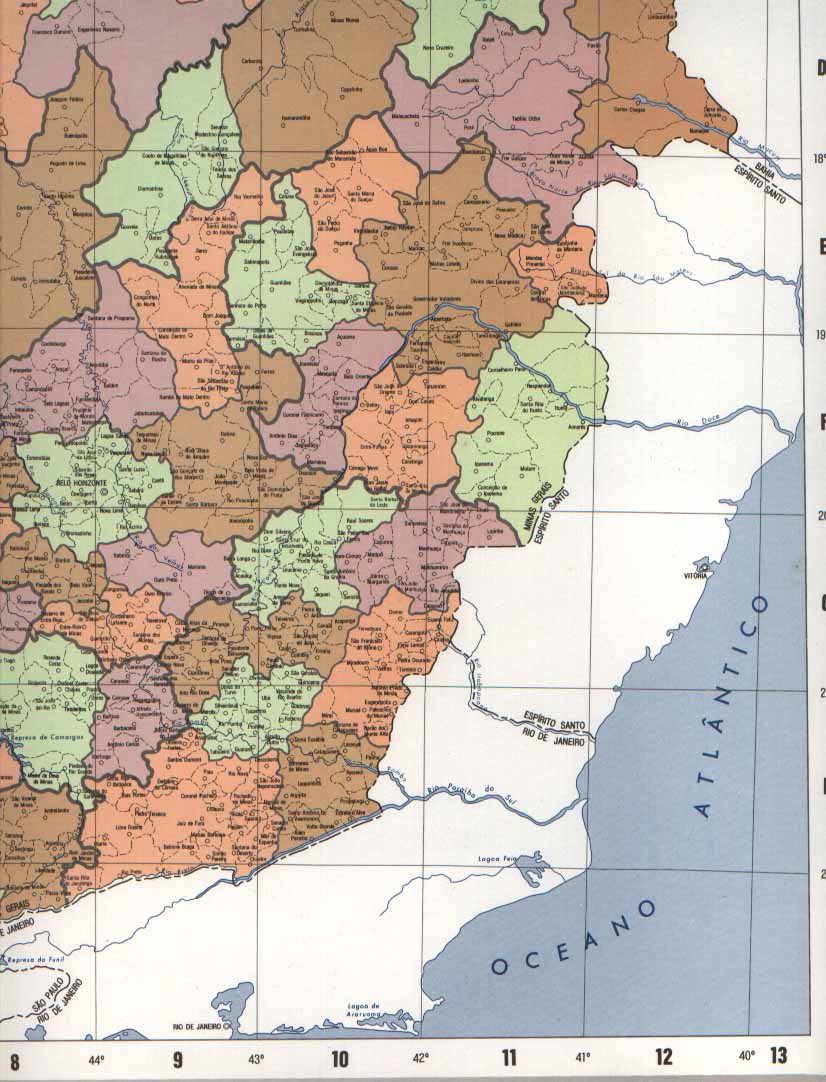
1115002007
MG Norte- Nordeste.JPG (109.23 Kb - 800 x 1115) |
 |
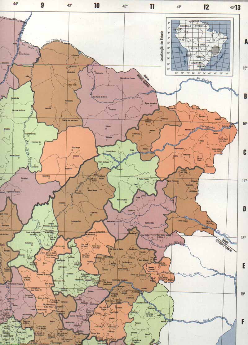
1115002008
MG Norte- Noroeste.JPG (102.75 Kb - 822 x 1082) |
 |
1115002009 MG Sul.JPG (144.10 Kb - 826 x 1082) |
 |
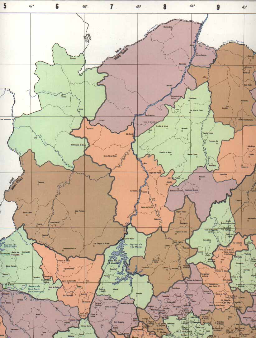
1115002010 MG
Triângulo.JPG (90.11 Kb - 820 x 1132) |
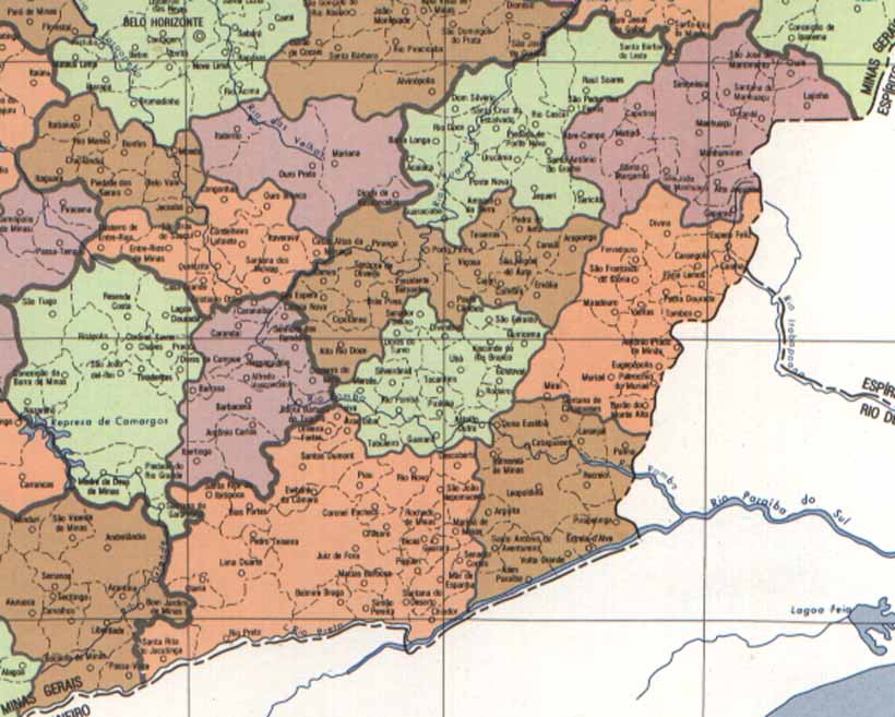 |
1115002011 MG
Zona Mata.JPG (79.28 Kb - 820 x 657) |
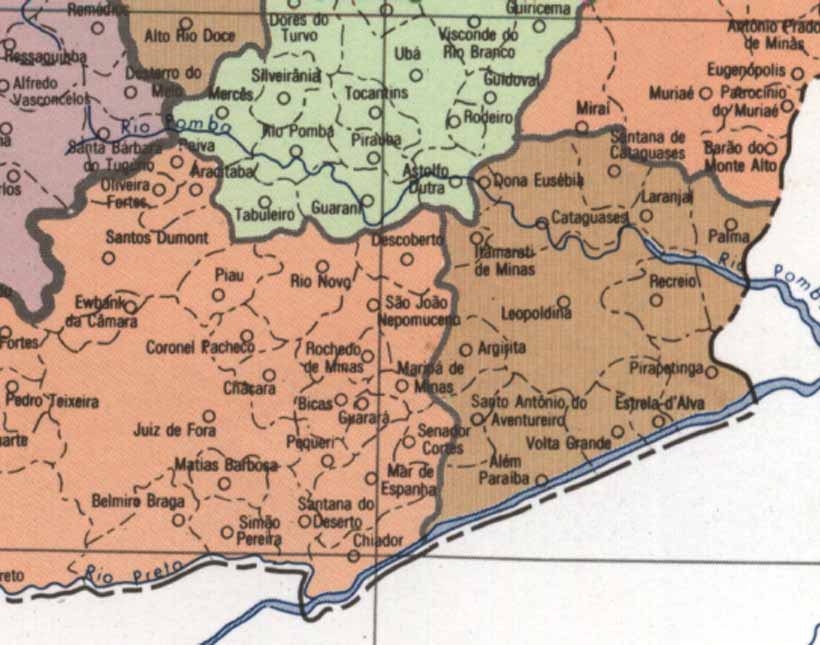 |
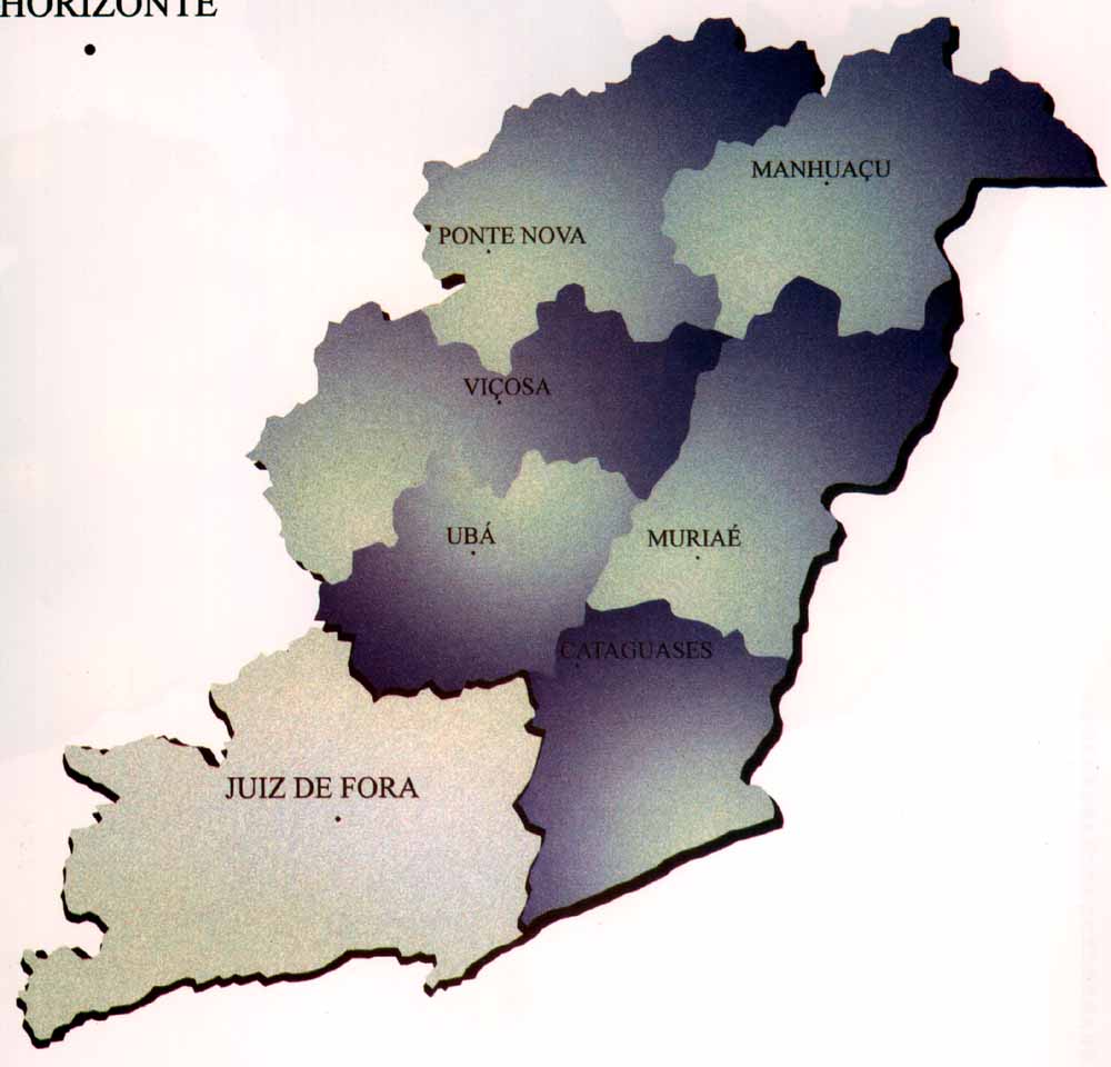
1115002012 ZM
Cataguases.JPG (64.22 Kb - 820 x 645) |
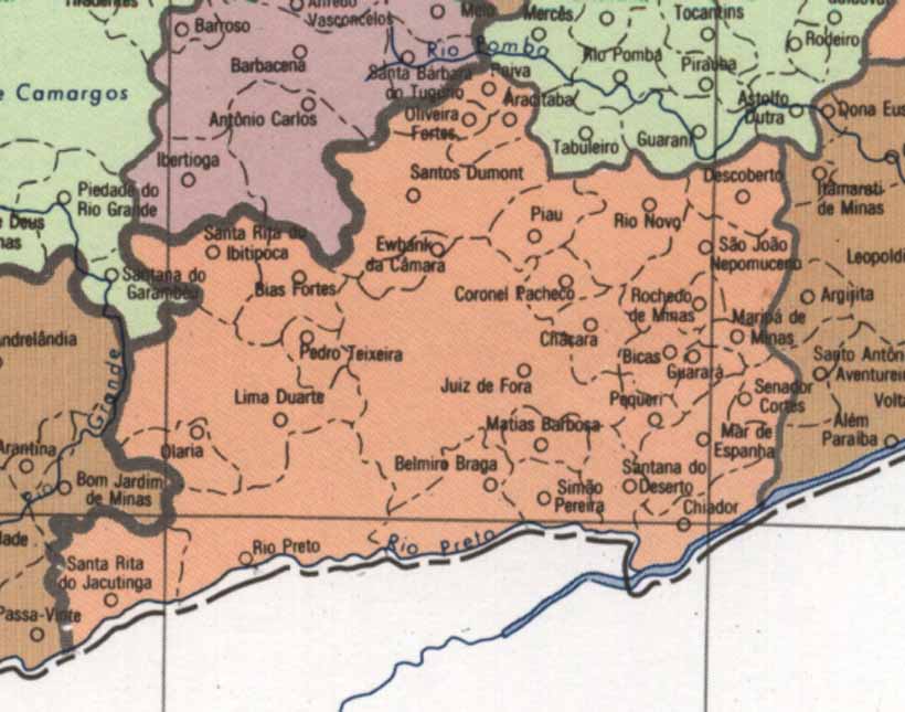 |
1115002013
ZM Juiz de Fora.JPG (62.61 Kb - 820 x 645) |
 |
1115002014 ZM
Manhuaçu.JPG (54.96 Kb - 820 x 645) |
 |
1115002015 ZM
Muriaé.JPG (59.51 Kb - 820 x 645) |
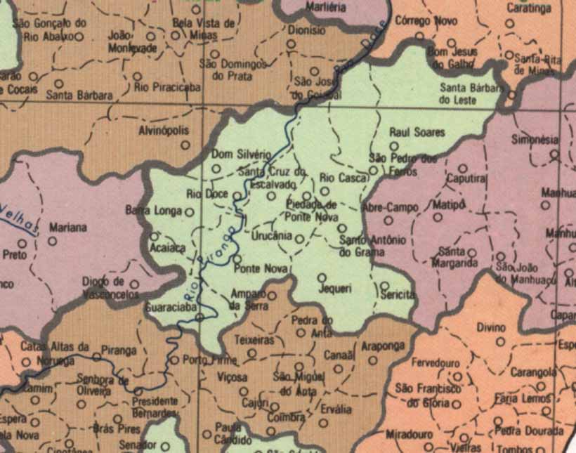 |
1115002016
ZM Ponte Nova.JPG (66.20 Kb - 820 x 645) |
 |
1115002017 ZM
Ubá.JPG (70.91 Kb - 820 x 645) |
 |
1115002018 ZM
Viçosa.JPG (69.21 Kb - 820 x 645) |
![]()